Sunday, July 26, 2015

Mount Monadnock - July 22, 2015

Mount Monadnock is located in Jaffrey, NH and is one of the most popular hiking spots in the entire world. With that said we knew that we'd need to go on a weekday in order to avoid the worst of the crowds.  Good thing we did because even in the middle of the week the mountain was very crowded, particularly with groups of kids running wild.

The drive up to the mountain was an uneventful two hours and after paying one of the rangers our $10 fee and getting a map we managed to get the one open spot left in the first main parking lot.  After gaining about 250' in elevation in the first half mile we can to the fork where the trail splits in to the White Dot trail and White Cross trail.  The ranger we spoke to on the way in recommended going up the White Dot trail and down the White Cross trail, partly as their way of helping to manage the hiker traffic on the mountain.  I can't think of another place where the rangers have to worry about traffic flow on a mountain.  These two trails are the most direct route to the summit which was about 1.9 miles each way. After the split in the trail the mountain began to get steeper and rockier.  We passed a few people as we climbed up the trail, and eventually caught up to a fairly large group of kids where the trail began to become more sheer granite and dangerous.  Whoever was in charge of those kids was nowhere to be seen, so we had to be careful going around them as they seemed oblivious to everything.  This mountain seems a little too dangerous for pre-teen kids to be goofing around on in my humble opinion.

The top of the mountain is very open and rocky.  Mount Monadnock offered breathtaking 360 degree views on a perfect New England summer day. In the absence of trees the trail is marked primarily with cairns (large piles of rocks), but all you really need to do is look towards the peak and head in that direction over the open rocks.  After getting a few obligatory pictures of the spectacular view we headed away from the summit for lunch to escape the crowd. 

The descent down the White Cross trail was a little tricky in spots where the rock was smooth and a bit slippery.  We didn't have any issues, but it would have been much more difficult if there was rain making the rocks even more slick. 

One of the cairns marking the way

Another of the cairns
 

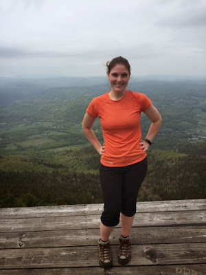
Angela and her pink sunglasses admiring the view

View of the summit from a few hundred feet below
 
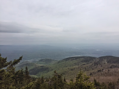
One of the only shots I could get from the summit without any people in view


Monday, May 25, 2015

Mount Ascutney May 16th, 2015

In order to hike "mountains" instead of "large hills" one must venture outside of Connecticut and head to a bordering state, so off we went to Vermont for the day. Mt. Ascutney's elevation is 3,150 feet and about a 6 mile hike out and back. The mountain is located in Windsor, VT and getting to the parking lot was a fairly short distance off of 91. There are a few different trails that will take you to the summit of Mt. Ascutney.  After doing our research it looked like the Weathersfield Trail was a suitable choice that offered great views, was challenging, and had some cool waterfalls thrown in the mix.

The Weathersfield Trail is well marked with white blazes. From the parking lot the trail ascends slowly among rocks and after .4 miles we came to our first spot, Little Cascade Falls. This falls had three small water falls that lead to a pretty good size drop. We decided this was a good spot to drop our packs for some photos. It was at this very spot where I was fiddling with my bag that I heard a loud thud and looked to see Ross franticly hanging on the side of the edge of a rock on the falls. He slipped on a muddy spot by the edge as it had rained the night before. I quickly showed off my strong muscles and pulled him up. As you can imagine this gave us quite a scare. He was a little bruised up, but luckily the only real injury was to one of his fingers. After that scare and Ross being banned from the edges of steep drops for the rest of the trip we continued on our way! :)

After .7 miles we came across Crystal Cascade Falls which are 84 foot falls. It was a nice spot to carefully play on the large rocks and enjoy the views of VT. The trail gets much steeper after this section over the next 1.2 miles.  The 1.2 miles due to it's steepness felt much longer. I could feel the calves burning on this one. We reached Gus's lookout, which was a large rock that was a great spot to sit and have lunch.  If it was a clear day it would have had terrific views of the surrounding mountains, but unfortunately for us it was a little overcast. We followed the trail .2 miles to West Peak Vista. This spot was breathtaking. It is a hang glider launch which has a wooden platform with no barriers where hang gliders jump off of the mountain. It was cool to stand on it and take some photos, but I could never imagine jumping off this thing into the open sky and mountains below. I haven't done my hang glider research, but how the heck do they know where to land?  We continued on our way another .4 miles and we finally reached the top of the mountain. The very top of the summit has a big communication tower on it and didn't offer much of a view, but a few hundred feet to the left of the summit there is a 24 foot observation tower that offered 360 views of the  near by mountains. My favorite thing about this observation tower, which I wish all observation towers had, was that it labeled on each side all of the mountains that you could see on top of the tower. Props to whoever worked on that one.

We reversed our course and headed back down the mountain. Going down was definitely a lot easier than going up. The rocks made it more challenging and we had to watch our footing, so we didn't twist an ankle. In total on the trip our elevation gain was about 2100 feet. Mt. Ascutney was an awesome day hike minus one of us almost falling down the side of a waterfall.

Crystal Cascade Falls

At the hang glider launch


At the launch!
 
Top of the observation tower on a cloudy day


Saturday, April 4, 2015

Mount Toby March 29th, 2015

A 45 Degree sunny day has been rare these last couple of months, so we decided to take full advantage and went out to explore Mount Toby. Mount Toby is located in Sunderland, Mass and unlike many mountains owned by the state this one is owned by UMASS.

We set out on the Robert Frost Trail which is orange blazed. The Robert Frost Trail is a 45 mile trail that runs thru the Connecticut River Valley of Massachusetts. The trails at this point were still covered in snow after a bad winter and we wore our micro spikes to help with traction. The trail was marked, but there were many junctions along this trail that had us stopping and second guessing ourselves on which way to go. There were a few junctions we came across which you could go one way or the other, but no signs that existed to let us know we were going the right way or any mileage. Perhaps some fine students as UMASS could work on this for a class project! 

At about .5 miles we turned right to follow the trail where we went further into the woods. We went about 1 mile where we reached another junction and turned right. The elevation started to gradually rise at this point and we crossed under telephone poles. It doesn't sound too picturesque when I mention telephone poles on a hike, but it was pretty peaceful and scenic. Plus the phone service of course  was fantastic...ok I can't confirm that one, but maybe I will check next time. We came to another fork in the trail where we went right and continued up the Robert Frost Trail. Going left would have lead us to the red blazed Upper Link Trail. The last .7 miles to the top of Mount Toby was pretty steep, but we knew what awaited us, so we kept trekking on.

The top of Mount Toby (1269 feet) has a nine story observation tower. There is no actual view from the mountain unless you climb the tower. I should have counted the number of steps to the top, but I was focused on not slipping and fallen since I'm rather clumsy. I'm proud to say we didn't have to take out the first aid kit on this hike! The very top of the tower was closed off, but I'm not sure if it's closed year round or if it's only open seasonal. The tower offered a fantastic 360 degree view of the surrounding mountains and we could even see our favorite Mount Tom.


Once back on solid ground we continued following the Robert Frost Trail to Summit Mountain Road for a little over 2.5 miles. This trail isn't actually a paved road, but a wider trail. This trail follows along Roaring Brook that was roaring pretty good with all the snow melting. We bypassed the Bypass Trail that was on the right, but wish we hadn't since after looking at a map it would have extended the hike to Roaring Mountain and linking us back to the trail that we were currently on. This trail is frequently used by horseback riders and I was pretty excited to have to move off the trail to let a couple of horses go by. Before we knew it we had looped back to the beginning of the hike and we were back at the car. Overall Mount Toby was a nice 5 mile loop hike, but UMASS needs to work on there trail signage!


Friday, March 6, 2015

Bromley Mountain VT - February 27, 2015

The biggest hike of our recent Vermont trip was up to the top of the 3,260' Bromley Mountain along the Appalachian Trail/Long Trail.  We found the parking lot on Route 11/30 fairly easily.  After walking a couple hundred feet down the snowmobile trail, we found the sign for the AT/LT that indicated we had 3 miles ahead of us to get to the summit.  The weather started out around 10 degrees, but with the sun shining brightly on us staying warm wasn't a problem. 

There hadn't been fresh snow for a little while so the trail was well broken in and easy to follow.  The woods were incredibly quiet and peaceful as we started up the mostly gentle incline towards the summit.  We crossed over the mostly ice and snow covered brook and also crossed over the snowmobile trail after having hiked about a mile.  There weren't any snowmobilers at the time so the woods remained very quiet and still as we carried on. 

After passing one of the shelters for backpackers to camp at, the trail began to get noticeably steeper and also less broken in.  This slowed our pace a little bit, but still wasn't overly strenuous.  We took a quick stop at the vista, which gave me a chance to take a few pictures and swap my heavy insulated gloves for a thinner pair. 

After our stop at the vista we carried on up the mountain and fought off the many branches that had grown into the trail.  Although we may have been able to walk under some of them if not for the thick base of snow we were walking on.  Eventually we passed a couple other hikers (the only others we saw on the trail that day) and the terrain briefly flattened out until we got to the ski area where we had to go the last quarter of a mile while watching the skiers and snowboarders casually glide down as we trudged upwards. 

We hadn't felt any wind the entire day until we reached the summit.  The combination of the relatively cold breeze and the fact that our snowshoes were a little out of place with the skis and snowboards led us to start heading back down pretty quickly after taking a few quick pictures of the impressive view. 

The hike back downhill was refreshingly easy after all the work getting uphill.  Even with the snack break we took when we got back to the shelter the trip down only took about an hour and a half.  The hike ended up being 6 miles and taking a little over 4 hours.


Angela at the summit.


That hat looks good everywhere.
Long Trail / Appalachian Trail signage on some old concrete.


Sunday, February 22, 2015

Mt. Tom Saturday February 21st, 2015

We frequently visit Mt. Tom located in Holyoke, MA. This mountain has a lot to explore during all four seasons including winter and it is conveniently close to our house. We woke up early Saturday morning as we knew the day would be fairly long if we wanted to reach the summit with all the snow on the ground. Plus the forecast was calling for another storm starting in the afternoon.

We parked in a parking lot that is almost halfway up the mountain on Reservation Road. At first you may think all the hard work is pretty much done since you drove half way up, but that certainly isn't the case. There is normally a $2 charge for parking, but during the winter there is no fee. Depending on weather conditions this road can sometimes be closed which has forced us to change our planned hike, but today it was open. One plus about Mt. Tom is that all the trail signs are very well marked along with the mileage.

The hike started on the Keystone Trail which is marked by red blazes. After .3 miles we took a right onto the Keystone Extension for another .7 miles. The Keystone Extension is also a red blazed trail (although I'd argue it's more of an orange). Both of these trails were pretty packed down as it hadn't snowed in over a week (seems as if that might be a record this winter for length without snow), so we didn't need our snowshoes to start. It was pretty quiet today on the trails which was probably due to the temperature and the approaching storm, but normally Mt. Tom isn't as quiet as one would think it is in the cold snowy weather of New England. After a short time on the Keystone Extension we saw about 6 deer playing in the snow in a distance. This was quite a sight to see, but they quickly scattered when they heard us. At the end of the Keystone Extension we came across an intersection which gives an option of either taking the DOC Trail or the Quarry Trail. We chose the DOC Trail which is .9 miles long and still marked with red blazes. This trail was less packed down and the further we went we found that we needed to put on our snowshoes. This part of the trail has some steeper sections than the other trails the closer you get to the top of mountain, but pretty manageable. One problem that we were running into was our Camelbak hoses were freezing while we were climbing due to the cold conditions, so we were constantly having to put the tube in our jackets to warm them up and blow water from the hoses back to the bladders, so we had a water supply.

Once we reached the top of the mountain we headed left onto the M&M Trail. The trail sign indicated 1.3 miles until the summit of Mt. Tom. This is a white blazed trail and with all the white snow on the trees and the rocks it made for a challenging time following the blazes. The snow at parts were packed down, but other parts you would take a step and I would sink into snow that was up to my thigh. It was pretty exhausting when trying to climb up hill at parts and having to pull your body our of thigh-high snow. The top of the M&M Trail is pretty unique as the trail follows rocky ledge cliffs for most of the way scrambling over rocks and boulders. At some spots I was a little nervous of slipping, but made sure to be very careful during those sections. Another challenge at the top of the mountain is that there were areas that were thigh-high snow, then there were areas that were packed in, and other areas by the cliffs edge where there was hardly any snow and bare rock showing. We constantly were taking off our snowshoes, putting them on, and taking them back out again as you don't want to traverse bare rock in snowshoes. We had brought micro-spikes with us in case there were icy conditions, but didn't end up using them. At one point while we were up there we lost part of the trail and detoured up a hill. Once we were up the hill we realized we were not going the right direction and headed back down. This looked a little steep and as I watched Ross in the distance I saw him fall face first into the snow and then attempt to toboggan down the hill like a penguin.  After a good laugh, I decided I didn't want to go down hill like that so I was proactive and decided to slide down on my butt.  The snow as this point was lightly covering a large rock. The slide wasn't as smooth as I had hoped and ended up being a little painful.  As we continued hiking Ross noticed that I had a huge hole in my snow pants across my butt. Yup, of course I didn't escape my clumsiness with a hole in my pants. We continued on the adventure as we could see Mt. Tom in the distance. On top of the trail we came across a few hikers. We looked at my watch and noticed that it was almost one o'clock and if we wanted to give ourselves plenty of time to get back before the park gates closed at 4 we needed to turn around. We were a little disappointed we didn't make it to the summit this time around as it looked a little under a 1/2 mile away, but with the time it took to trudge thru the deep snow that would take us at least half an hour or so to get there plus back.

At this point we reversed our course back on the M&M Trail and took a right onto the red blazed DOC Trail.  After getting past the last of the bare rock on the M&M Trail we decided to leave our snowshoes on the whole way back. While we were on the DOC Trail the snow started to come down, so it was probably another good reason we turned around when we did. We reached the Keystone Extension and then took a left at the end of the trail onto the Keystone Trail back to our car. In total we went 5.7 miles in about 4 1/2 hours. 2 1/2 of those hours consisted of going thru snow that was thigh deep which is why the time and distance seem a little off. This is where we spent a lot of energy and took a while to trudge thru. Mt. Tom is a beautiful spot to visit in the winter as you hike thru the woods and up to the picturesque snow covered cliffs on top of the mountain. There a lot of different trails that you can explore. We are determined next time to wake up even earlier so we have plenty of time to make another attempt to summit Mt. Tom in the winter.

Part of the trail packed down

The beginning of the M&M Trail

Some of the thigh-high snow
 
A view from off the cliff ledge on top of the mountain overlooking the town below